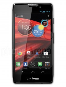
 I was visiting South America, and I took pictures with my new Droid Razr Maxx. To help me geotag the images, I also took along my GPS device; I know the camera has a GPS, but when you are traveling, Android data plans are too much, so I shut off the data service and only use voice+text. You can use voip phones melbourne for your business.
My usual photo work flow is to take the track file from my GPS device and apply geotags to the jpg’s from my camera. I have done this with my old phones, point and shoot, and fancy DSLR camera. I love geotagging photos. Geotags remind me where the picture taken so that I can do a better job of putting captions on photos.
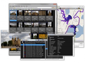
 There are several opensource or commercial programs that can do the tagging function. My favorite is the tool is Geosetter. You load a track file (*.gpx) into Geosetter, you point the program at a directory of photos, and it matches the photo’s time stamp to the closest timestamp in the track file — that’s where it finds the lat/long coordinates. Those are then inserted into the EXIF text of the image.
Just one problem:
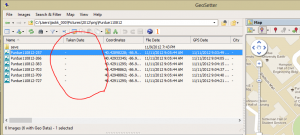
the Droid Razr’s jpg files don’t have the DateTimeoriginal timestamp field populated. Geosetter depends on that timestamp to be there. “All” other camera use this timestamp to record the time the picture was taken (vs record that time the file was created). Geosetter won’t work with these jpgs.
But, I found a geotag fix!!
You need to run a magic tool called exiftool. The tool runs from a command prompt. I know it is kinda of a hassle to run, but it will save you a bunch of hassle. You need to change to the folder that is holding the jpgs that need to be fixed and you need to run the following command:
exiftool "-DateTimeoriginal<ModifyDate" *.jpg
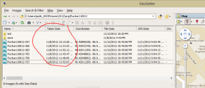
After the tool is run, and you refresh the Geosetter (F5), then you see the Date Taken column filled-in. (and the tool is now happy).
When this column is filled in, then you can run the “Sync with GPS” command and get the geotag information written into the jpg files.
It seems like a picky thing, but when you take 30 or more pictures on a trip, it is much easier to run a Geosetter tool than setting the geotags manually.
Just so you know, the installation of the exiftool is tricky. Since I run Geosetter, exiftool is already installed, but hidden in the Geosetter Profile FIles directory. To make exiftool work, you need to find the path it sitting in and update the system path environment varilable. Kinda of a hassle. Also, you will notice that before I ran exiftool, I created a backup directory and copied all the original jpgs, there, just in case exiftool hoses things up.


